
Primal Sensors - Location Tracking for Commercial Construction
Primal Sensors was Jerry’s first venture scalable startup. The original idea was to be able to track participants in real-time at obstacle course races. The idea was all about fun. After some time pitching this idea, construction companies took notice and asked if the technology could be used for large commercial construction sites. The idea was sound. Have tracking tags on pallets of materials, equipment and parts, and laborers. The construction companies could monitor their construction sites using location data and travel patterns to adapt their construction sites to be more efficient, safer, and accountable.
Problem Statement:
Large commercial construction sites can encompass acres and mile of terrain that is ever changing as the project progresses. With million of dollars in equipment, materials, and personnel moving within the site, there is infinite potential for lost and stolen property, misplacement of materials, and lack of visibility of accidents and personnel activities.
Solution Statement:
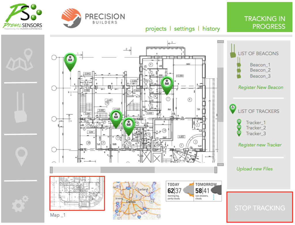
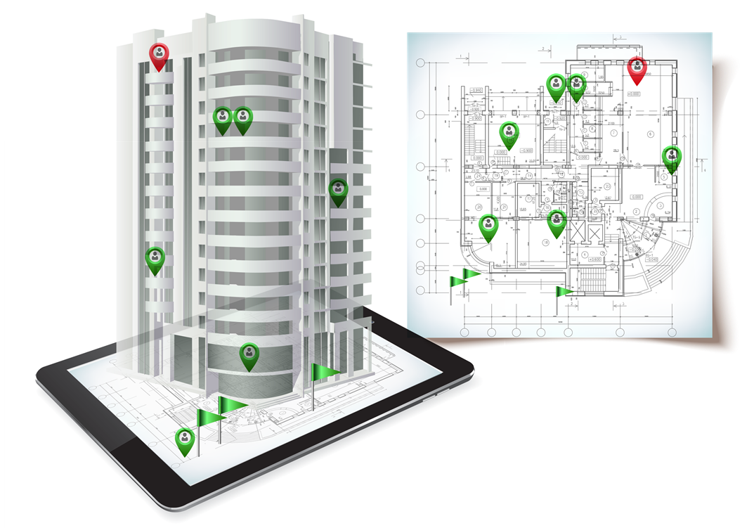
Primal Sensors provides a platform that shows the location of tagged equipment, pallets of materials, and onsite personnel to increase visibility and accountability within those project sites. Using movement data and location tracking, the project manager can maintain control of the assets of that project while also using such data to contour and adapt the project site for more efficient placement and workflow.
Product Description:
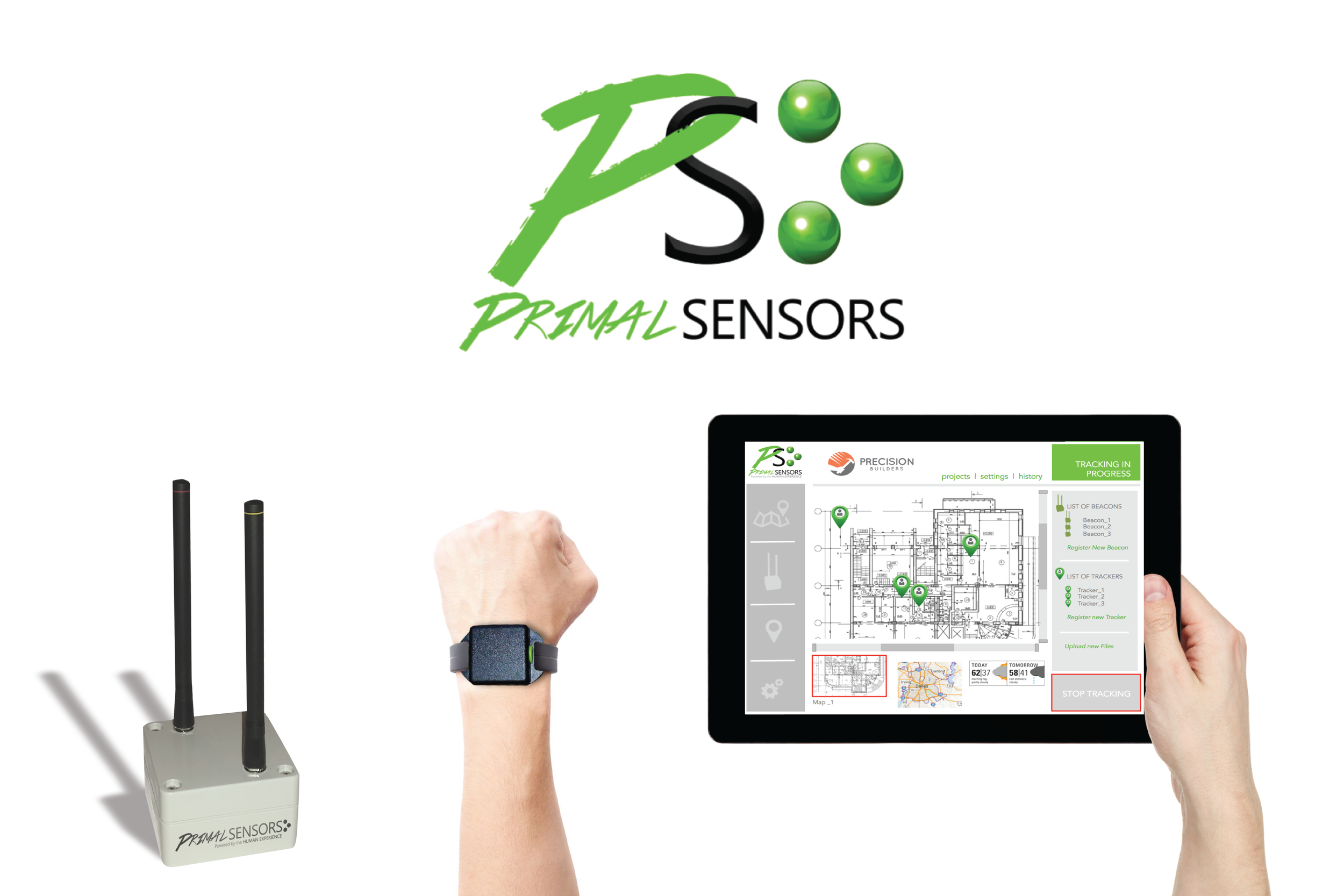
The tracking tags were small 1x1x0.5 inch encased long range RF transmitters. The chip was programmable to alter the location ping timing for various use cases. The tags communicated with RF antennas connected in a mesh network. The network calculated the location of every tag using classic triangulation calucations producing relative the location of potentially hundreds of location tracking tags within the networked site. The locations would then render on a PDF uploaded mapping software.
Product Scope:
The project started out focused on the Obstacle Course Racing market (Spartan Race, Tough Mudders, etc). Over acres and miles of terrain, race organizers need to know where all the participants were. Spectators wanted to keep track of their racer. And racers wanted to know where the rest of their group was to meet them at the finish line. To achieve this, we needed a scalable hardware solution that was mobile, durable, and plug and play. Ultimately, there was no money in this kind of market. But, the commercial construction market had a hard need to track lots of stuff over similar site sizes. So, we pivoted.
At the time, the construction market had various blueprint management platforms, such as PlanGrid, that were already in use on projects. Primal Sensors trying to build a new one and then sell that whole system to large commercial construction companies was a pointlessly long endeavor. To cut the sale cycle, we chose to make the location data only available via API and rely on partnerships to sell the technology. This allowed us to focus on the sale of the hardware system capabilities instead of trying to replace current ideal software solutions.
What I would do differently:
I’d spend money on creating a demo system. Find a company that wanted to do a free 30 day trial using our own dumb software version. While this is working, I’d go establish partnerships with all the blueprint management software companies. The trial data would be what sells this. We never got that far because we ran out of money and time.